The Mapit menu
The Mapit menu is located in the top right corner of the gadget. This is where you choose which filters to display issues from, as well as map source(s).
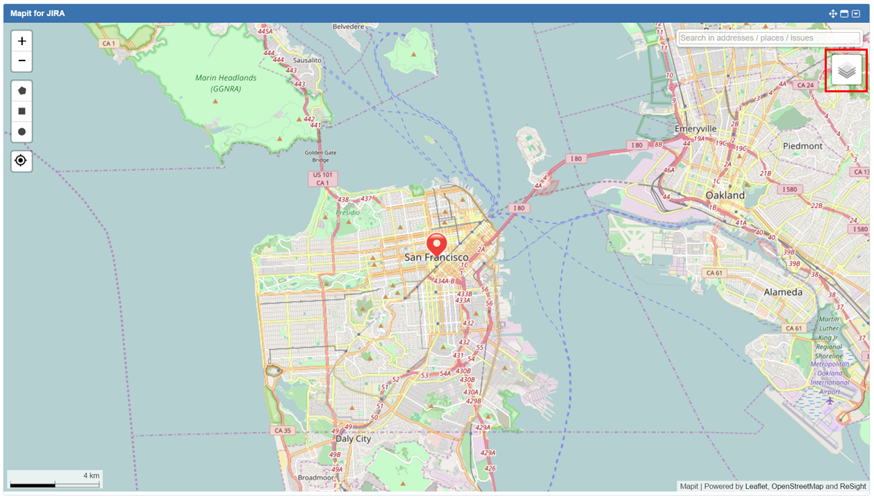
Click on the menu icon to open the menu.
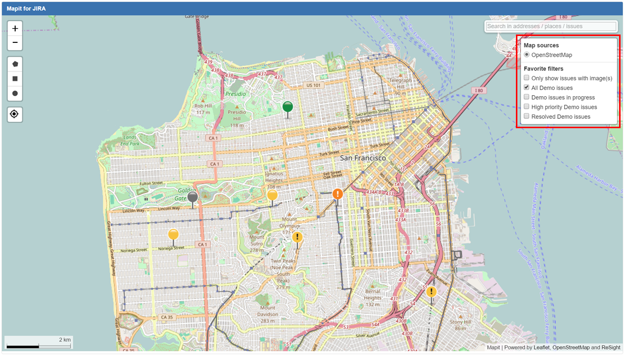
Click anywhere outside the area covered by the menu to close it. The name of the activated filter will show in the information bar at the bottom.
Map source selector
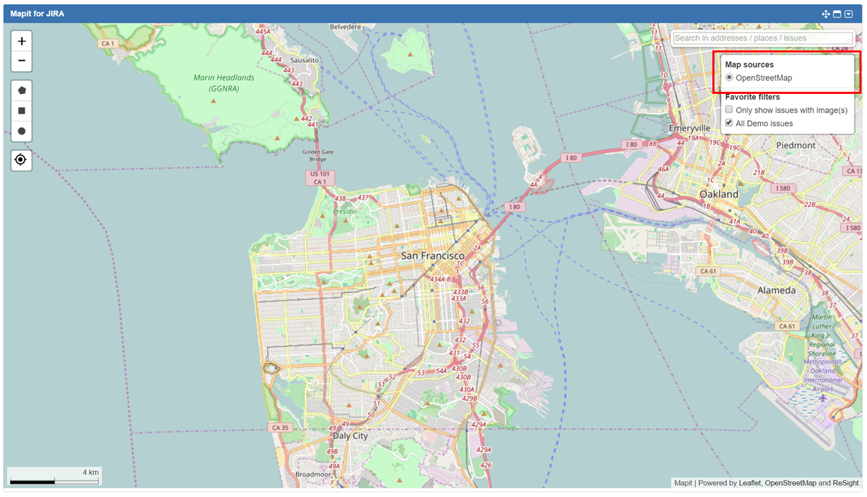
OpenStreetMap is the default map source, but your JIRA Administrator can both add other sources and choose a different default source.
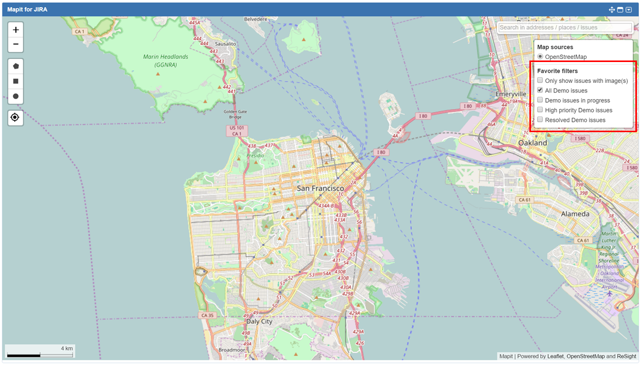
Filters
Mapit lists all your JIRA favorite filters in the filter section of the menu, as well as a couple of special filters. All filters are listed in the Filters section of the Mapit menu.
Limitation of the number of displayed issues.
When creating filters for Mapit - remember that only the first 50,000 issues will be displayed on the map.
"Only show issues with image(s)" filter
This is a special filter provided by Mapit. When checking this filter, Mapit will only show the issues containing image attachments from your current filter selections.
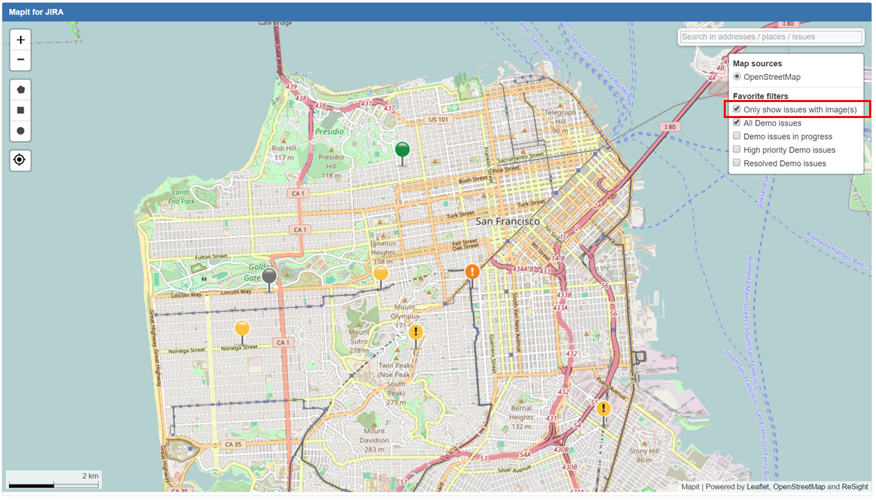
So if you have checked your favorite filters A and B in the Mapit menu, then click "Only show issues with image(s)" (followed by a refresh of Mapit), only the issues in filters A and B containing image attachments will show in Mapit.
After selecting this filter, you need to refresh Mapit for the function to take effect.
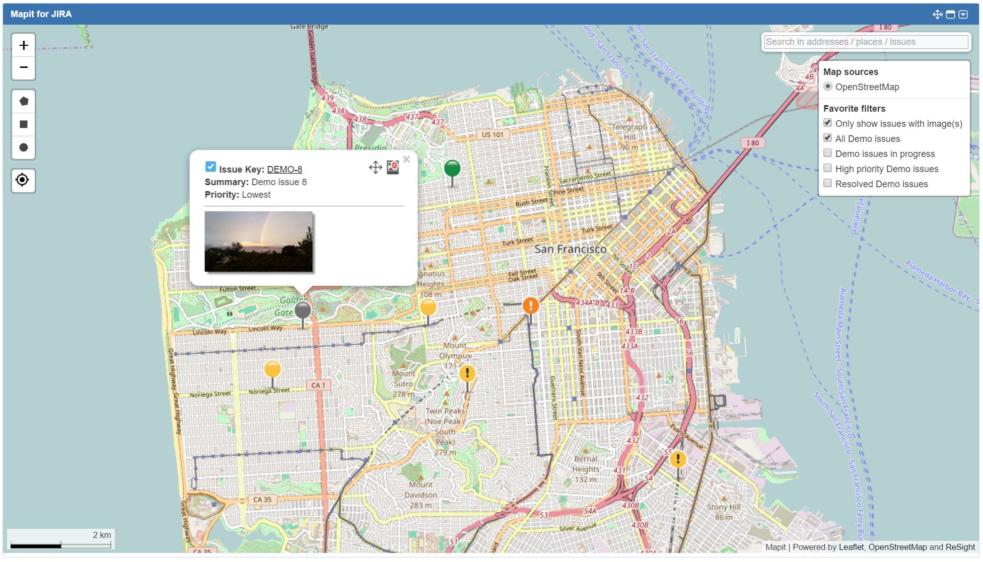
When this filter is checked, and you click on an issue, the issue popup will automatically expand to show thumbnails of the issue's attached images. Clicking on an image will open it in a new tab.
Mapit default filter
If you are using a shared dashboard, the dashboard owner might have set up Mapit to show a default filter. This filter will be pre-selected, and will appear just below the "Only show issues with image(s)" filter. The name of the filter will vary.
JIRA favorite filters
When you tick the checkbox next to the filter you want to display, Mapit will display the issues from this filter in the map.
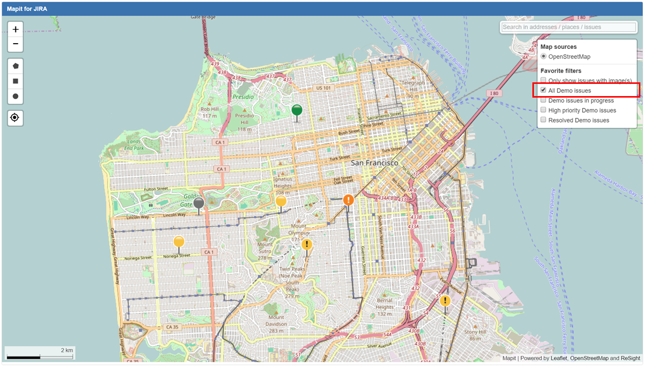
Only geotagged issues (issues with valid geographic latitud/longitude coordinates) will be displayed in the map.
You can select any number of filters to display, but if you select a lot of different filters, which all return a large number of issues, this might impact performance. You can reduce the number of filters shown by marking some of them as not favorites.
Please refer to the JIRA documentation for more information about managing filters