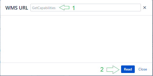
If WMS URL you entered is correct, then a list of available layers will be displayed.Select the ones you want to share with users of the Mapit gadget, fill in the Attribution field and then press the Add new WMS source button
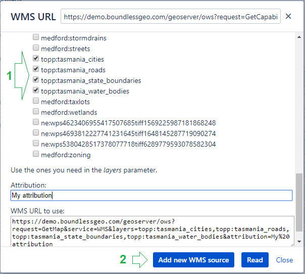
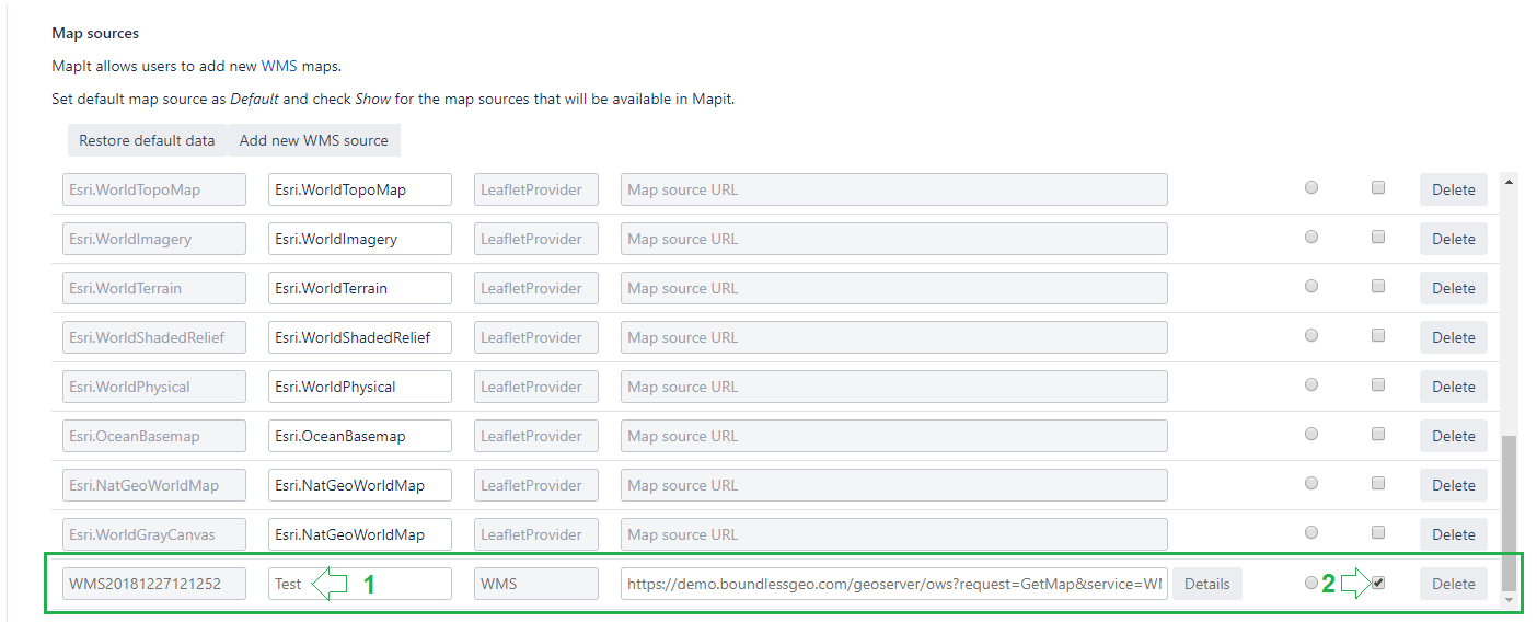
As a result, you will receive a new row in the table (as shown below). Enter the name that will be visible in Mapit gadget and check the checkbox in the Show column - to share the WMS layers. You can also make this the default layer, by choosing the Default radio button.
The Details button will allow you to return to the dialog box with previously selected layers, to makecanges . You can delete the data row with the Delete button, as long as it is not set as the default map source.
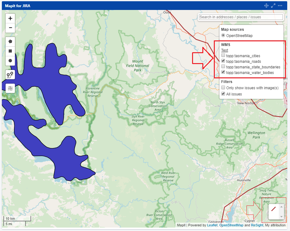
Now go to Mapit gadget and check the availability and correctness of the layers added by you in the new WMS section.
That's all.
Successful work with WMS layers.
JavaScript errors detected
Please note, these errors can depend on your browser setup.
If this problem persists, please contact our support.