Custom field setup
Before you can start using the Mapit plugin, you need to set up some custom fields to store location information for issues.
1. Geographic coordinate system
Select which geographic coordinate system you would like to use for storing the issue position. Supported formats are latitude/longitude (default) and UTM.
You can change the geographic coordinate system at any point, but please note that issues created with one system will not show on the map after the change. So if an issue has been created and stored UTM information, it will not be able to show in the map if setting is chaged to lat/long.
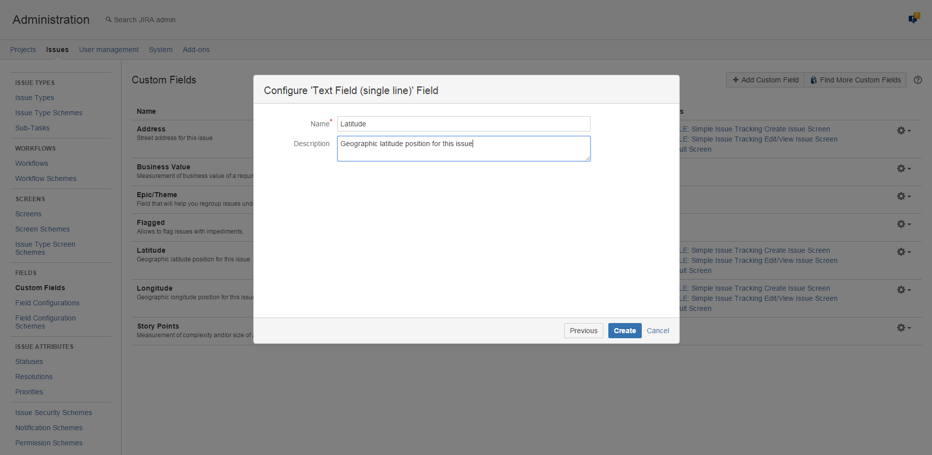
2. Creating custom fields
Mapit makes use of 3 different custom fields to store location information. If you don't have these fields already, you need to create them:
- A custom field to store geographic latitude position.
We recommend that the custom field name contains "Lat" or "Latitude" (or translations of these). We also recommend adding some explanatory text in the custom field description, such as: "Geographic latitude position for this issue. Format is decimal degrees, e.g. 52.5170365"
- A custom field to store geographic longitude position
We recommend that the custom field name contains "Long" or "Longitude" (or translations of these). We also recommend adding some explanatory text in the custom field description, such as: "Geographic longitude position for this issue. Format is decimal degrees, e.g. 13.3888599"
- A custom field to store address information
We recommend that the custom field name contains "Address" for clarity.
If you have opted for UTM Geographic coordinate system, use only one field holding the value with the position.
If you have opted for UTM Geographic coordinate system, you need 2 different custom fields.
- A custom field to store UTM position.
We recommend that the custom field name contains "UTM" (or translation). We also recommend adding some explanatory text in the custom field description, such as: "Geographic UTM position for this issue. For instance: 33 N 562288 7632649" - A custom field to store address information
We recommend that the custom field name contains "Address" for clarity.
Please refer to the following Atlassian documentation page for more information on how to create custom fields:
3. Placing custom fields on screens
The custom fields (latitude position, longitude position and address or UTM position and adress) need to be placed on issue screens in order for them to be visible to your users. If creating custom fields from the admin section, you will be asked to do this in the last step of the creation process, but you can also do this manually. Please refer to the following Atlassian documentation for your preferred method:
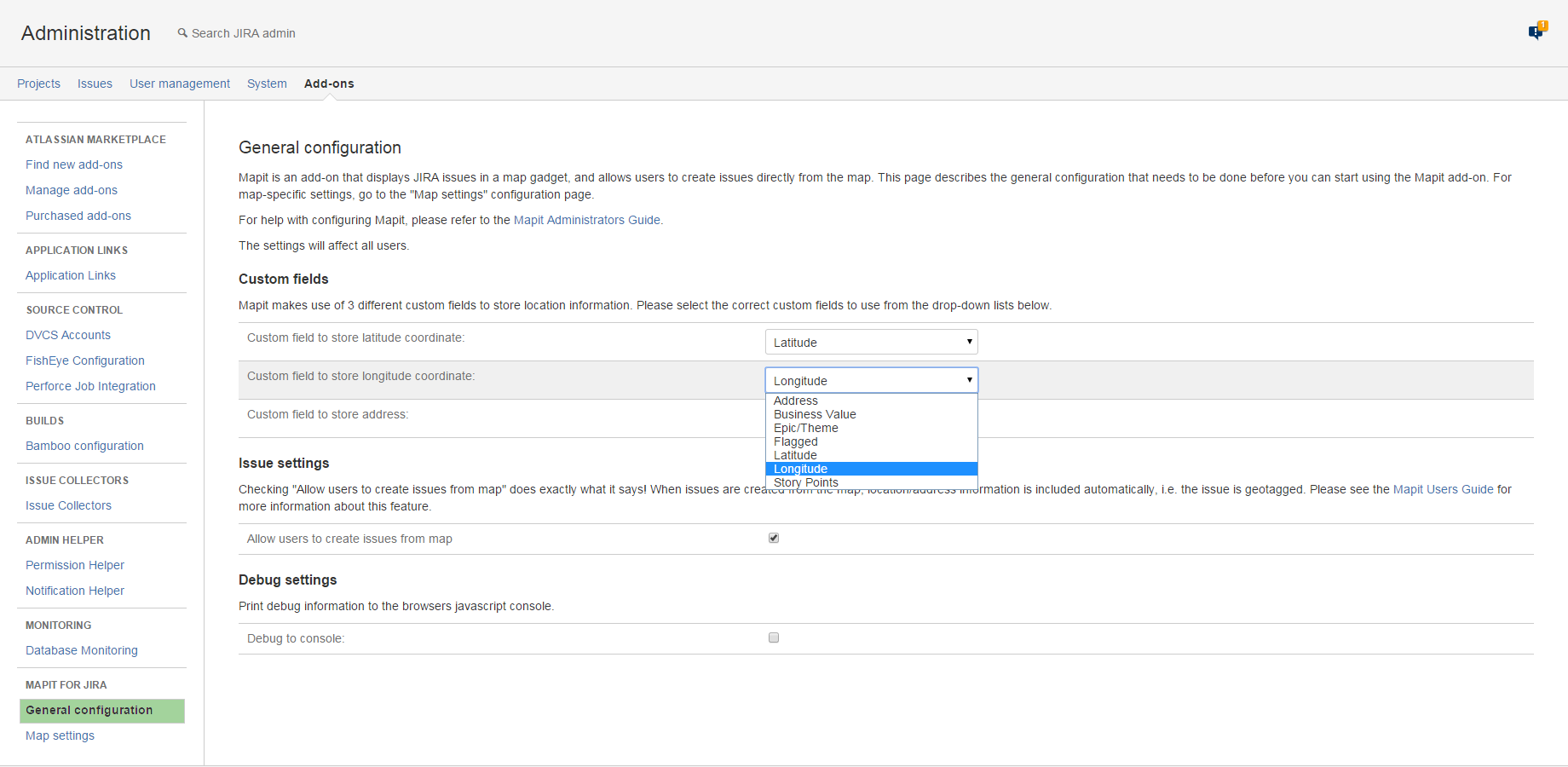
4. Associate custom fields with Mapit parameters
Once the custom fields have been created, they need to be mapped to the correct Mapit parameters. Go to the add-ons administration section of your JIRA instance, and choose "General configuration" in the Mapit Configuration section.
- First, select the custom field that should be used to store latitude position
- Next, select the custom field that should be used to store longitude position
- Finally, select the custom field that should be used to store address information
Only custom fields of supported types will be listed in the drop-downs.
All custom fields must be of the supported types:
- Text Field (single-line)
- Elements Connect custom fields (formerly nFeed)
- Scripted Fields (ScriptRunner)
Remember that used custom fields must be searchable. Learn more about configuring custom fields and Search templates.