Configuring map settings
This page refers to the configuration of map-specific settings for the Mapit plugin. General configuration settings are covered in the General configuration page.
Changes in the Mapit configuration pages are stored when you hit Enter or move to the next setting.
Default map center and zoom value
These settings define what geographical area your users will see the first time he or she uses the Mapit gadget. Once they start using it, Mapit will remember the user's last zoom level and area.
The default map center could for instance be the position of your company's headquarters, or the center of the city of your main operation. You can find the geographic latitude and longitude position by searching for the correct address in Mapit (if you've set it up already), or searching in OpenStreetMap or other map sources such as Google Maps or Bing Maps.
The format of the geographic latitude and longitude coordinates must be in decimal degrees (DD), omitting the degree symbol, e.g. 68.12345 or 68,13456.
Latitude coordinates must be in the range -90.0 to 90.0. Longitude coordinates must be in the range -180.0 to 180.0.
Copy the latitude and longitude coordinates to the corresponding fields in the Map settings page.
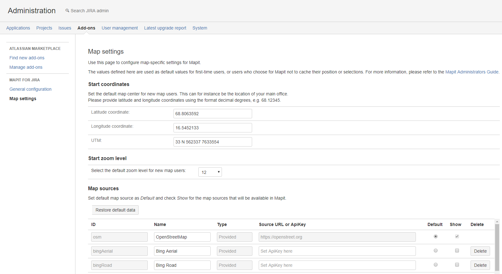
You can also set the start zoom level for new map users. The zoom level is a numerical value, that approximately corresponds to the following map scales (with examples):
- 1: 1:20 000 kilometers (world view)
- 6: 1:200 kilometers (country/part of continent)
- 11: 1:5 000 meters (large city)
- 15: 1:300 meters (main street names, landmarks)
- 18: 1:40 meters (detailed street view with street names/numbers, restaurants, etc.)
The maximum start zoom level you can set is 18, the minimum is 1 (world view).
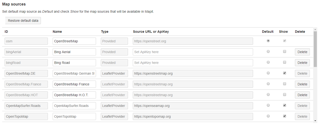
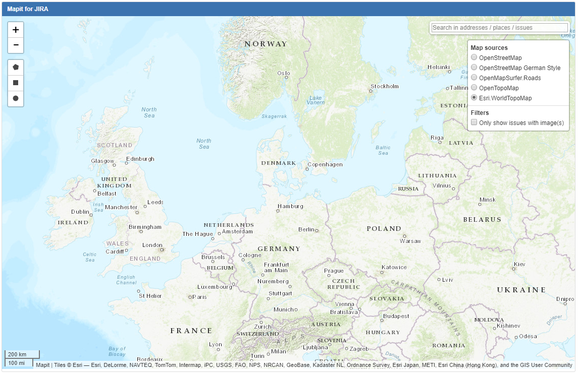
Map sources
Mapit supports many alternative source maps. Set default map source as Default and check Show for the map sources that will be available in Mapit.
If no changes have been made then OpenStreet map source will be used by default. The names that will be displayed in Mapit-gadget can be edited. For Bing map sources, API Key is required.
Searchengine source
Some search providers are availabli in Mapit, note that the Geonorge option is only relevant in Norway.

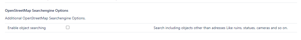
OpenStreetMap Searchengine Options
In this section You can enable/disable (default) the Searchengine option which will allow you to search for objects other than addresses.
Only for OpenStreetMap
License
The OpenStreetMap data is available under the Open Database License, and the cartography is licensed as CC BY-SA. http://www.openstreetmap.org/copyright
The Leaflet JavaScript library is © 2010–2014 Vladimir Agafonkin, 2010–2011 CloudMade.